City Plans, Programs, and Regulations
Staff will coordinate across departments to ensure that any recommended changes are consistent with City plans (e.g. the Comprehensive Plan), programs, and regulations (e.g. the Development Code).

There are existing, in-progress, and future City plans, regulations, and programs that the Environmental Review project will need to align with. Project-wide resources are listed under 'City Plans and Programs' and 'City Regulations'. Resources that are primarily related to one project topic are listed under 'Project Topics', along with resources for community members (e.g. incentives, best practices, technical assistance).
Staff will coordinate across departments to ensure that any recommended changes are consistent with City plans (e.g. the Comprehensive Plan), programs, and regulations (e.g. the Development Code).
City Council ultimately approves changes to City ordinances and the adoption of City plans. The Planning Commission makes recommendations to City Council.
There will be multiple opportunities for community input throughout this project. Community engagement is an opportunity for all community members to share their ideas, backgrounds, and experiences to plan a future where everyone can thrive.
This project will be informed by both quantitative and qualitative data, using resources such as the U.S. Census, Virginia Department of Conservation and Recreation, and community feedback.
Staff are responsible for providing community engagement opportunities, preparing technical documents, drafting recommendations, coordinating with internal staff and relevant partner agencies, and presenting to the Planning Commission and City Council.
Stormwater is rainwater or melted snow that runs off of streets, yards, parking lots, and other sites. Not all rainwater is absorbed into soil, and unabsorbed rainwater ultimately ends up in our waterways, picking up pollutants along the way. Stormwater is managed in Charlottesville through a combination of humanmade (e.g. pipes, ditches, vegetated swales) and natural infrastructure (e.g. natural stream). The stormwater infrastructure system in Charlottesville includes a combination of public and privately-owned facilities. In the city, there are approximately 35 miles of open waterways and 130 miles of storm drains. Stormwater management addresses both water quantity (volume/flow of water) and water quality. Insufficient stormwater management can cause downstream flooding, stream bank erosion, degraded water quality, and property or infrastructure damage.
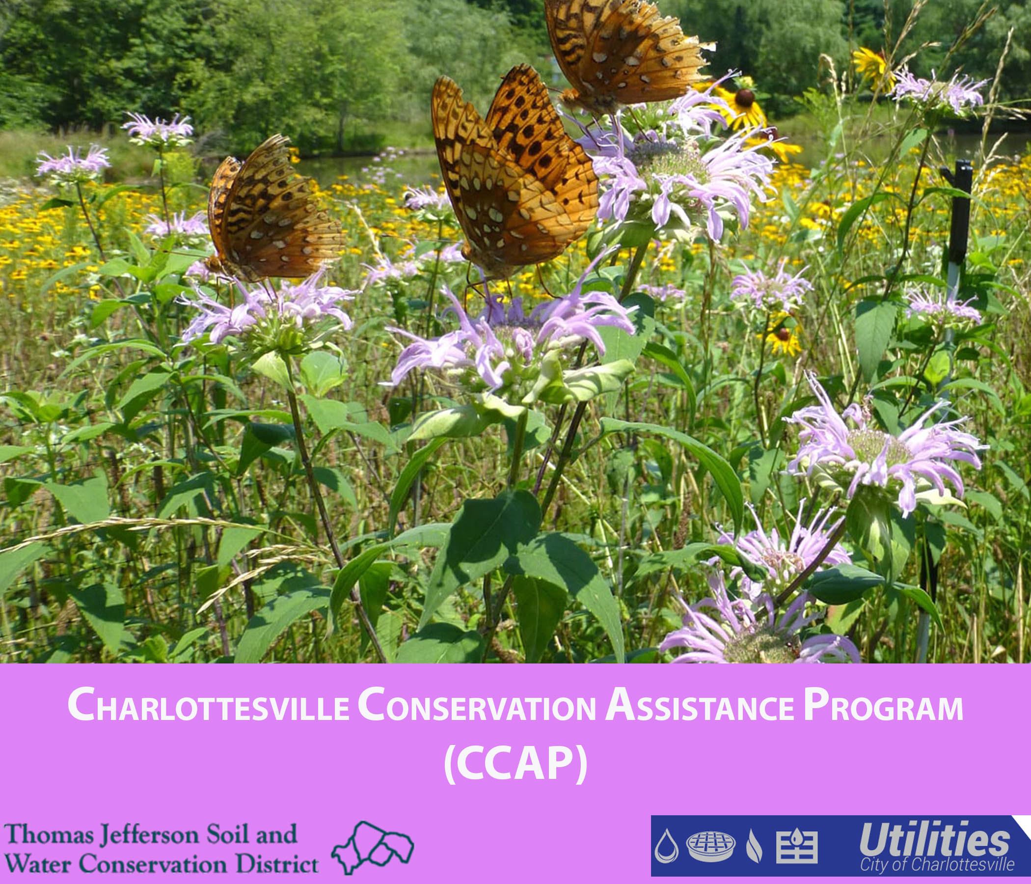
Overview of the City's Stormwater Utility, including information about the Stormwater Utility Fee and stormwater management projects to protect our waterways. There are also resources available for financial, technical, and educational assistance to property owners in Charlottesville who intend to install eligible stormwater control practices on their property, including Conservation Assistance Programs.
City Stormwater Management Program
Since our stormwater system drains to surface waters, Charlottesville is required to develop a Stormwater Management Program. There are six key elements of the program, which are addressed through the development and implementation of best management practices (BMPs) and will lead to water quality improvements through the reduction of pollutants to the maximum extent practicable.
Stormwater Management Requirements for Development
Chapter 10 of Charlottesville's Code of Ordinances includes the City's Virginia Erosion and Stormwater Management Program (VESMP), which regulates erosion and sediment control and stormwater management for land disturbance activities (including development).
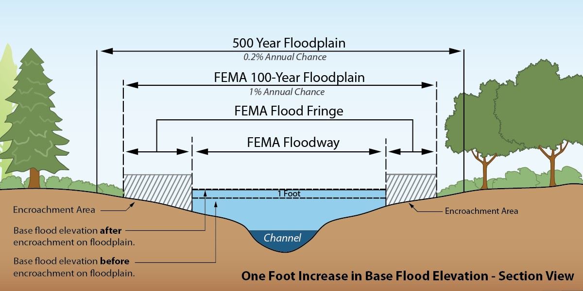
A floodplain or flood hazard area is defined as any land subject to 1% or greater chance of flooding in a given year. The City receives flood maps from the Federal Emergency Management Agency (FEMA) and regulates floodplain management through the Flood Hazard Protection Overlay District. The intent of regulations is to prevent loss of life and property and deter the creation of health and safety hazards. The mapped flood zones are primarily surrounding the Rivanna River, Meadow Creek, and Moore's Creek. Approximately 7% of parcels in the city are within mapped flood zones. However, there are areas outside of mapped flood zones that flood, due to topography, inadequate drainage infrastructure, and other factors.
Credit: Pierce County, WA
Resources and strategies to address the impacts of flooding. Allows the City to apply for Community Flood Preparedness Fund grants through the Department of Conservation and Recreation. The City has been awarded four of these grants to date. The most recent grant award will be used for a Floodplain Management Program review and Flood Resilience Plan update.
Flood Hazard Protection Overlay District
An overlay district that constitutes the floodplain management regulations for the City. This is part of the City's Development Code (Div. 2.9) and starts on Page 2-69.
Protecting and expanding our urban tree canopy is a priority in the City's Comprehensive Plan. The City is currently updating its Urban Forest Management Plan to analyze existing conditions and develop recommendations to increase tree canopy, remove and prevent invasive species, and find ways to fit street trees into constrained right of ways. Increasing our tree canopy will need to involve tree planting and management on both public and private land. Existing tree canopy varies significantly by city neighborhood, and neighborhoods with lower tree canopies tend to have higher temperatures (urban heat island effect). The City regulates tree canopy and street trees through development requirements and provides guidance for tree protection during development.
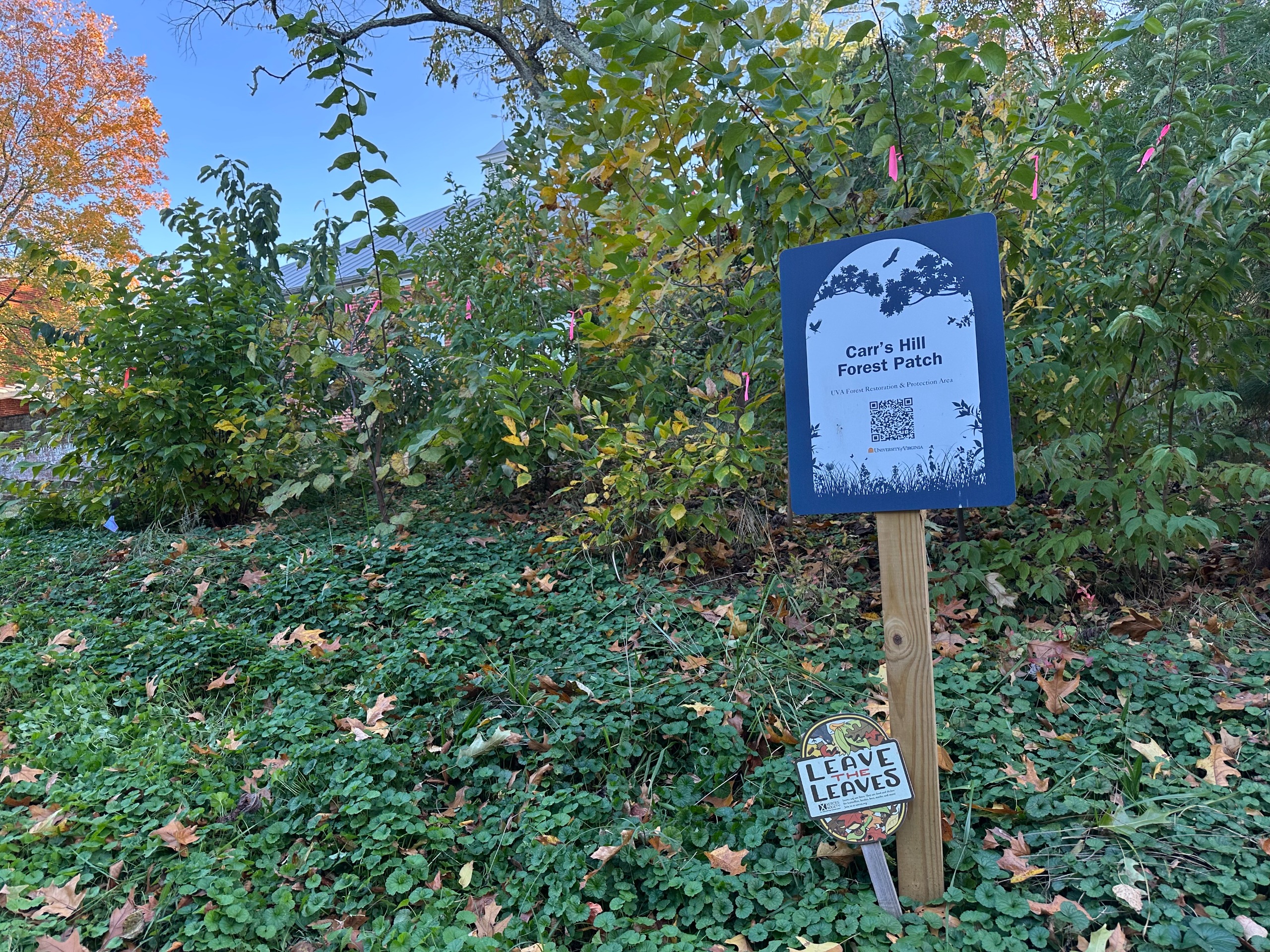
Includes urban canopy reports, project updates for the Urban Forest Management Plan (anticipated completion in 2026), invasive species projects, and resources for planting new trees.
City Tree Canopy and Street Tree Requirements
The City's Development Code includes requirements for tree preservation, replacement, and canopy (4.9.1) and street trees/streetscapes (4.4.5).
Best Management Practices for Tree Preservation, Transplanting, Removal, and Replacement
Best practices to inform tree planting and preservation during development.
Charlottesville Urban Heat Islands Study
An analysis by the UVA Center for Community Partnerships on Charlottesville's temperatures and tree canopy by neighborhood.
Stream buffers are vegetated areas on each side of a stream or river bank. Tree and plant roots hold banks in place and help slow runoff, filter pollution, prevent soil erosion, and provide shade to keep waterways cooler. In Charlottesville, three waterways have regulated stream buffers through the Water Protection Ordinance (WPO): the Rivanna River, Moore's Creek, and Meadow Creek.
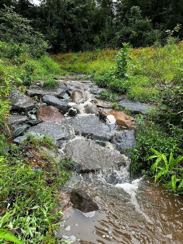
Water Protection Ordinance Requirements for Development
Chapter 10 of Charlottesville's Code of Ordinances includes the City's WPO Stream Buffer requirements for the three designated waterways, including allowable buffer disturbances and activities.
Meadow Creek Restoration and Schenks Branch Tributary Restoration
Information on two stream restoration projects completed by the City in collaboration with partner organizations.
Critical slopes are defined in the Development Code with the following criteria:
The purpose of protecting critical slopes is to limit the disturbance of steep slopes near waterways, adjacent waterways, and environmentally sensitive areas to protect from the impacts of erosion and stormwater and to preserve habitats. There are exemptions for certain activities and infrastructure in critical slopes, such as public utilities and stormwater management facilities. Applicants can also request a special exception, which requires review by the Planning Commission and City Council.
City Critical Slope Requirements
The City's Development Code includes the definition and requirements for critical slopes (4.10.1) along with the special exception criteria and process (5.2.16).
The City's GIS Viewer includes a layer for critical slopes.
The City has a variety of energy efficiency programs and resources for both residential and commercial properties. Additionally, State Code requires certain local government new construction projects (including those greater than 5,000 square feet) to meet energy efficiency requirements.
The Energy Resource Hub connects homeowners, renters, and businesses in the City of Charlottesville and Albemarle County with rebates and incentives.
Charlottesville Utility Incentives
These include assistance with insulation, thermostats, and weatherization.
Charlottesville Green Incentives and Rebates
Incentives and resources to support and promote green building practices for both commercial and residential properties.
Electric Vehicle (EV) Charging Resources
Information about EV chargers, siting and design guidelines, and EV charging initiatives.
Development Code Requirements for EV Charging
Requirements for EV charging with development, including required number of spaces for EV charging (4.5.4.C3), design and placement (4.5.5.C4), and screening (4.7.4.B2).
Citywide guiding document with broad policy recommendations on a range of topic areas, including land use, community facilities, environmental stewardship, and housing. Includes Small Area Plans and transportation plans that are adopted as part of the Comp Plan.
Framework for how the Charlottesville community can work together to achieve our emissions reduction goals of 45% reduction by 2030 and carbon neutrality by 2050 through building and energy, transportation, waste, and nature-based strategies.
The City is engaged in a collaborative planning effort with Albemarle County and the University of Virginia. The City's resulting Adaptation and Resilience Plan will have strategies to adapt to the effects of climate change, improve public health, ecosystems, and economic vitality, and reduce greenhouse gas emissions.
Water Resources Protection Program
Includes the stormwater utility, Stormwater Management Program, addressing aging infrastructure, and water quality and quantity management.
Highlights existing projects and programs that support watershed protection and increased tree canopy as key tools for managing runoff and improving urban resilience. Also shows opportunities for tree planting locations.
Regulations for property development in the city, including zoning ordinances and ordinances providing for subdivision of land. Includes regulations for development in the floodplain, critical slopes, and tree canopy requirements.
Water Protection Ordinance (WPO)
Includes regulations for stormwater management, erosion and sediment control, and stream buffers.
Have questions or want to learn more about a project, contact us below:
| connect@charlottesville.gov | |
| Website | www.charlottesville.gov |